Truckee Trails

blixet

iMTB Rockstah
Looking for recommendations/info on riding around the area. Never been and don't know much at all about it. I'll be spending a week in Truckee next month and want to find blue/intermediate trails in the vicinity that I can check out. Prefer flow to chunk, not death march or hard core black diamond tech. Something for the slow, old, recreational mtb tourist to enjoy and make it back to the hotel. Thanks in advance!
 
There are many trails in the area that you will enjoy. I was just there, but sadly, without my bike or doctor's clearance to ride. I've ridden three or four in that area, but I don't remember the trail names. Jackass? (Now called Donkey something), Sawtooth? Donner Lake Rim Trail sections?

Paging @mike He knows the area very, very well. And here's a link to Trailforks in the area.

Be advised that Donkey Teeth or whatever (formerly Jackass) was closed for maintenance or fire prevention area or something when I was up there last week. I'm told it's been closed all summer.
 
My in-laws live in Truckee and I ride that area quite a bit. As @herzalot suggested Sawtooth would be a solid choice but more of a green, the lower part of Big Chief would be a good blue type trail and it’s right by Sawtooth. The upper section of Big Chief is double black in some spots and has some pretty sketchy (for me) sections. Both Big Chief and Sawtooth are off 06 Fireroad. It is a bit of a steep climb up the fire road to get to the start of Big Chief, but worth it. Hole In The Ground is also a good option. Downieville is only 90 minutes away if you can get away for the day!

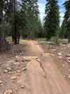
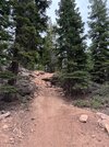
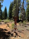
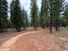
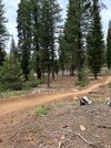
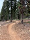
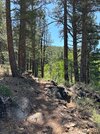
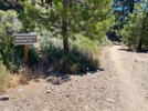
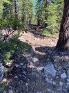
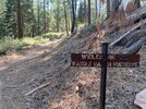
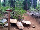
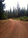
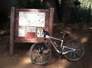
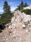
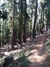
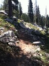
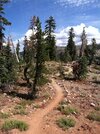
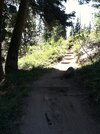
Here are some pics from the area. Happy to help with any suggestions.
 

Attachments

  • IMG_0294.jpeg
    IMG_0294.jpeg
    1 MB · Views: 41
  • IMG_0293.jpeg
    IMG_0293.jpeg
    1.1 MB · Views: 41
  • IMG_0304.jpeg
    IMG_0304.jpeg
    1.1 MB · Views: 43
  • IMG_0291.jpeg
    IMG_0291.jpeg
    901.2 KB · Views: 41
  • IMG_0290.jpeg
    IMG_0290.jpeg
    1.1 MB · Views: 47
  • IMG_0289.jpeg
    IMG_0289.jpeg
    1.1 MB · Views: 36
  • IMG_0264.jpeg
    IMG_0264.jpeg
    1.1 MB · Views: 44
  • IMG_2398.jpeg
    IMG_2398.jpeg
    964.7 KB · Views: 46
  • IMG_7582.jpeg
    IMG_7582.jpeg
    951.4 KB · Views: 41
  • IMG_7572.jpeg
    IMG_7572.jpeg
    1,001.4 KB · Views: 40
  • IMG_3721.jpeg
    IMG_3721.jpeg
    1.1 MB · Views: 42
  • IMG_3724.jpeg
    IMG_3724.jpeg
    793.8 KB · Views: 41
  • IMG_0307.jpeg
    IMG_0307.jpeg
    760.8 KB · Views: 43
  • IMG_0304.jpeg
    IMG_0304.jpeg
    1,016.8 KB · Views: 43
  • IMG_0308.jpeg
    IMG_0308.jpeg
    1.1 MB · Views: 45
  • IMG_0314.jpeg
    IMG_0314.jpeg
    867.6 KB · Views: 40
  • IMG_0311.jpeg
    IMG_0311.jpeg
    1,003.9 KB · Views: 47
  • IMG_0329.jpeg
    IMG_0329.jpeg
    857.8 KB · Views: 43
Stuff not yet mentioned that is nearby:

Stanford Rock Trail in Tahoe. Rebuilt a couple years ago with awesome bermed turns all the way to the top. Really nice climb. Descend the switchbacks or make it a loop using Ward Canyon Tahoe Rim Trail.

Tahoe Rim Trail in Tahoe City - nice flowy trail. https://www.trailforks.com/route/tahoe-city-tahoe-rim-trail-loop-4-hours/

Tahoe Rim Trail - Brockway Summit on Hwy 67 to Mt Baldy

Ignore the black rating for most of these trails on Trailforks. Most are blue with maybe a harder section or two.


Stuff a bit further away that is worthwhile:

TRT from Tahoe Meadows (Hwy 431) to the Marlette Flume and Chimney Beach Tr or Spooner. TRT open to bikes on even days only. There is a shuttle from Spooner lake area.

Incline Flume to Marlette Flume is a good alternate if you can't ride TRT to Flume. Or TRT to Incline Flume, which could be looped.

TRT, Spooner Lake to The Bench. Out and back.

If someone can shuttle you, both Clear Creek Trail and Upper Sierra Canyon trail are fun descents from TRT down off the mountain to Nevada.

Lots of other great rides on TRT and connectors but these trails are more chunky and backcountry type trails.
 
Thanks everyone for all this information. It should be very helpful. I have a Trailforks subscription which helps a lot in not getting lost but looking at all of the little blue spaghetti lines around the area makes planning out my kind of rides in the unknown difficult.
 
Trailforks shows popular routes that include certain trails. Easier to see on the web version but on the app if you click on a trail, and then click on Routes it will show the list of recent rides people have done. And for some, it will show popular routes.
 
I just tried it on Sawtooth and got a great looking route that is right up my alley. Thanks for reminding me about this. :thumbsup: It gives me a better idea of how to string some things together.
 
Great suggestions here.

The blue (lower) part of Big Chief with Happy Face DH finish (start at Sawtooth TH, approach on Road 06).

Tahoe Rim Trail from Martis Peak to Brockway summit (easily ridden both directions).

Stanford Rock Trail, loop or out-back.

Clear Creek Trial, out-back from James Lee Park, includes the new Lower CCT or other new options to Jacks Valley TH, continue up as far toward Spooner Summit as desired. Or shuttle from Spooner Summit TH like the skidiots do.

Sierra Canyon Trail, approach via TRT from Kingsbury North TH or Spooner Summit TH. Finish on Lower SCT to Snowshoe Drive.

Point to point TRT from Tahoe Meadows to Marlette Flume to Spooner Summit as described by mtbMike. Not flow but a lot of smooth and flat. Finish around the N side of Spooner Lake to Hwy 50.
 
Back
Top